
Cascade-Sierra
The volcanic peaks and conifer slopes of the Cascade and Sierra Nevada ranges.
 SunPlanner Get SunPlanner
 Scenery inside SunPlanner
SunPlanner offers 14 scenery regions for the Dashboard. Choose the region nearest your location, ask for a daily surprise from the scenery you have downloaded, or pick one yourself. The scene responds to the selected forecast conditions and local time while the forecast numbers stay in front.

All 14 regions
Region names and descriptions match the current Android scenery library.
The volcanic peaks and conifer slopes of the Cascade and Sierra Nevada ranges.

Red sandstone canyons and Mojave foothills of southern Nevada and the desert Southwest.

The rolling shortgrass plains of Texas, Oklahoma, and the southern Great Plains.

The Sonoran Desert of southern Arizona, home of the towering saguaro cactus.

The Mojave and Chihuahuan deserts of the arid Southwest, southern California to West Texas.

The rugged Pacific coastline of California and the West Coast.

The marshes, bayous, and barrier islands of the Gulf and southern Atlantic coasts.

The sagebrush sea of the Great Basin high desert across Nevada and the interior West.

The tallgrass and mixed prairie of the central Great Plains.

The high alpine peaks and valleys of the Colorado Rockies and the central mountain west.

The deciduous hardwood forests of the Appalachians and the eastern United States.

The temperate rainforest of the Pacific Northwest, lush and green year round.

The boreal northwoods of lakes and pine across the upper Midwest and Great Lakes.

The treeless arctic tundra of Alaska and the far north.
Weather examples
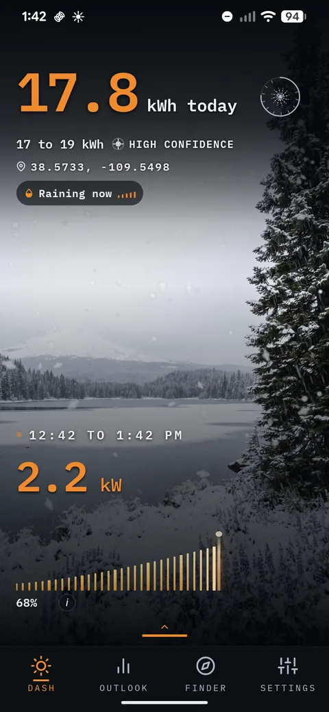
These nine app captures show scenery rendered for selected forecast conditions. They are examples, not live weather readings and not a promise that a scene will match every detail outside your window.



The scenery is the setting
Daily energy, the expected range, confidence, and the PowerBar remain forecasts for the setup and location you select. The landscape gives that information a place without turning it into live telemetry.